Indian
Burning and Catastrophic Forest Fire Patterns
of the Oregon Coast Range, 1491-1951
Bob Zybach
2003
CHAPTER 1. INTRODUCTION: HYPOTHESIS AND SETTING [WORD.doc: 52 pp.]
CHAPTER 3. INDIAN BURNING PATTERNS, 1491-1848
CHAPTER 4. CATASTROPHIC FOREST FIRE PATTERNS, 1491-1951
********************************************************
TABLE OF CONTENTS
CHAPTER 1. INTRODUCTION: HYPOTHESIS AND SETTING
A. Hypothesis
1) Rainfall
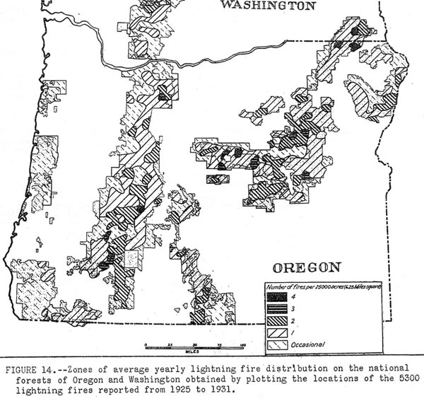
3) Lightning
D. Vegetation and Fuel Patterns
E. Summary
A. Research Boundaries and Focal Points
2) Persistent vegetation patterns
3) Literature
6) Historical maps and surveys
7) GIS layers
8) Other
D. Summary
CHAPTER 3. INDIAN BURNING PATTERNS, 1491-1848
CHAPTER 4. CATASTROPHIC FOREST FIRE PATTERNS, 1491-1951
CHAPTER 5. DISCUSSION AND CONCLUSIONS
A. TextsB. Maps
Appendix A. Oregon Coast Range plants and animals, ca. 1750.
Appendix B. Oregon Coast Range
landmark names, 1788 to 1951.
Appendix C. "The Big Fire":
William Smith Interview, 1910.
Appendix D. Alseya Valley to Alsea Valley, 1853-1915: GLO background and index
Appendix E. Historical
Maps vs. Historical Theme Maps, 1850-1940
Appendix F. Douglas-fir Region Indian prairie afforestation: Moravets 1932
Appendix G. Oregon Coast Range forest fire history, 1491-2003
Appendix H. Alsea
Valley prairie relicts, April 14, 2003
Fig. 2.01 Grassy bald on Marys Peak, 1885.
Fig. 2.02 Sources of living memory, 1929.
Fig. 2.03 Aerial photo of Alsea, Benton Co., Oregon, 1948.
Fig. 2.04 Tsp. 14 S., Rng. 7 W. annotated GLO field notes, 1856.
Fig 2.05 Alsea North Fork ridgeline trail network, ca. 1800-2003.
Fig. 3.01 Native people of the Oregon Coast Range.
Fig. 3.02 Large wood products, Oregon Coast Range, 1788-1860.
Fig. 3.03 Sauvies Island seasonal flood, pre-1941 dike completion.
Fig. 3.04 Willamette Valley, 1845-1888.
Fig. 3.05 Soap Creek Valley, 1914-1989.
Fig. 3.06 Alsea Valley prairie relicts, 2003.
Fig. 4.01 Precontact Douglas-fir and white oak old-growth, 1841-2003.
Fig. 4.02 Logging of Clatskanie River basin, 1895.
Fig. 4.03 Millicoma Fire reforestation, ca. 1946.
Fig. 4.04 Yaquina Burn, Toledo, Lincoln Co., Oregon, 1885.
Fig. 4.05 Yaquina and Nestucca burns, ca. 1902.
Fig. 4.06 Coos Burn, Elk Lake slide, 1894.
Fig. 4.07 Tillamook Fire mushroom cloud, 1933.
Fig. 4.08 Tillamook Burn snags, ca. 1935.
Fig. D.01 Aerial photo of Grass Mountain balds and trails, 1966.
Fig. D.02 Aerial photo of Prairie Peak prairies and trails,
1967.
Map 1.01 Location of the Oregon Coast Range study area.
Map 2.01 Oregon Coast Range study index.
Map 2.02 Tsp. 14 S., Rng. 8 W. GLO subdivision and DLC survey index.
Map 2.03 Clackamas Indian village and burial ground, 1856.
Map 2.04 Tsp.
14 S., Rng. 8 W., Sec. 22 timber cruise, 1915.
Map 2.05 Oregon
State Forester's 1914 Fire Map.
Map 2.06 USGS Coos Bay 30 min. quadrangle map, 1895-1896.
Map 2.07 1895-1896 USGS Coos Bay Quad GIS map.
Map 2.08 1900 USDI Forests of Oregon GIS map.
Map 2.09 1914 ODF Forest Fire GIS map.
Map 2.10 1936 PNW Forest Type GIS map.
Map 2.11 Tsp. 14 S., Rng. 8 W., "Indian Trail to Tidewater"segment,
1856.
Map 2.12
Alseya Valley towns, trails, and campgrounds, ca. 1800-1850.
Map 2.13 "Alseya Valley" land use
patterns ca. 1850 GIS map.
Map 2.14 Tsp. 14 S., Rng. 8 W., Sec. 14 timber cruise map, 1915.
Map 2.15 Alsea Valley forest fire patterns, ca. 1850-1936.
Map 2.16 Alsea Valley section-scale comparisons, ca. 1850-1936.
Map 3.01 Oregon Coast Range tribes and nations, ca. 1770.
Map 3.02 Northern Coast Range landscape patterns, ca. 1800.
Map 3.03 Soap Creek Valley, ca. 1826 GIS map.
Map 3.04 Soap Creek Valley, ca. 1850 GIS map.
Map 3.05 Eastern Coast Range landscape patterns, ca. 1800.
Map 3.06 Western Coast Range landscape patterns, ca. 1800.
Map 3.07 Southern Coast Range landscape patterns, ca. 1800.
Map 4.01 Historic Oregon Coast Range forest fires, 1750-1933.
Map 4.02 Tsp. 4 N., Rng. 8 W., Sec. 35 timber cruise map, 1913.
Map 4.03 Clatsop County Tsp. 4 fire patterns, 1868-1936.
Map 4.04 Northern Oregon Coast Range forest fire patterns, 1720-1936.
Map 4.05 Clatsop County logging patterns, 1900-1940.
Map 4.06 Columbia County logging patterns, 1900-1940.
Map 4.07 Soap Creek Valley cultural forest age classes, 1650-1992.
Map 4.08 Eastern Oregon Coast Range forest fire patterns, 1720-1936.
Map 4.09 Western Oregon Coast Range forest fire patterns, 1720-1936.
Map 4.10 Siletz River basin forest fire patterns, 1849-1966.
Map 4.11 Alsea Valley forest fire patterns, 1900-1936.
Map 4.12 Alsi tribe foot, horse, and canoe trails, 1826-1853.
Map 4.13 Alsea River basin forest fire patterns, 1849-1936.
Map 4.14 Coos Bay forest fire patterns, 1895-1936.
Map 4.15 Southern Oregon Coast Range forest fire patterns,
1720-1936.
Map 6.01 Land ownership patterns of the Oregon Coast Range, 2003.
Map 6.02 Historical Alsea landscapes vs. federal old-growth reserves.
Map D.01 Alsea Valley original land surveys index.
Map D.02 Tsp. 14 S., Rng. 8 W., GLO Donation Land Claim (DLC) surveys, 1856.
Map D.03 Tsp. 15 S., Rng. 8 W., GLO survey error with corrections, 1893-1941.
Map D.04 Grass Mountain balds and trails, 1966.
Map D.05 Prairie Peak prairies and trails, 1966.
Map E.01 USDI BLM "Teensma" fire
history maps, 1850-1940.
Map E.02 Teensma mosaic patterns: Alsea Valley, 1850-1940.
Map E.03 Pacific Ocean coastal strip comparisons, 1850-1940.
Table 1.01 Oregon Coast Range seasonal climate, 1961-1990.
Table 2.01 Early journalists of the Oregon Coast Range, 1788-1849.
Table 2.02 Original
GLO surveyors of Alseya Valley, 1853-1897.
Table 2.03 Sources and descriptions of GIS layers used for this study.
Table 2.04 Conversion of 1936 vegetation legend to 2003 GIS pattern.
Table 3.01 Oregon Coast Range tribes, rivers, and counties, 1770-1893.
Table 3.02 Oregon Coast Range pre-1849 Indian burning practices,
pre-1849.
Table 3.03 Native plant environments of "Alseya Valley",
1853-1897.
Table 3.04 Seasonal locations of Oregon Coast Range Indian fires.
Table 3.05 Principal native food plants of the Oregon Coast Range.
Table 3.06 Principal native food animals of the Oregon Coast Range.
Table 4.01 Historic Oregon Coast Range forest fires, 1750-1951
Table 4.02 Historic western forest fire yearss, 1849-2003
Table 5.01 Comparison of Indian burning and catastrophic
fire patterns
Table A. Native plants and animals of the Oregon Coast Range