The Great Fires: Abstract and Table of Contents
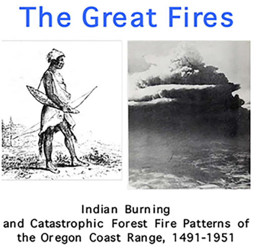
Zybach, Bob 2018. The Great Fires: Indian Burning and Catastrophic Forest Fire Patterns of the Oregon Coast Range, 1491-1951 (2nd Edition). NW Maps Co., Cottage Grove, Oregon: 364 pp. [$85.00 Hardcover; $20.00 PDF]
ABSTRACT
This study was designed to examine the relationship between land management practices of Indian communities prior to contact with Europeans and the nature or character of subsequent catastrophic forest fires in the Oregon Coast Range. The research focused on spatial and temporal patterns of Indian burning across the landscape from 1491 until 1848, and corresponding patterns of catastrophic fire events from 1849 until 1951. Archival and anthropological research methods were used to obtain early surveys, maps, drawings, photographs, interviews, Geographic Information Systems (GIS) inventories, eyewitness accounts and other sources of evidence that document fire history. Data were tabulated, mapped, and digitized as new GIS layers for purposes of comparative analysis. An abundance of useful historical evidence was found for reconstructing precontact vegetation patterns and human burning practices in western Oregon. The data also proved useful for documenting local and regional forest fire histories. Precontact Indians used fire to produce landscape patterns of trails, patches, fields, woodlands, forests and grasslands that varied from time to time and place to place, partly due to demographic, cultural, topographic, and climatic differences that existed throughout the Coast Range. Native plants were systematically managed by local Indian families in even-aged stands, usually dominated by a single species, throughout all river basins of the study area. Oak, filberts, camas, wapato, tarweed, yampah, strawberries, huckleberries, brackenfern, nettles, and other plants were raised in select areas by all known tribes, over long periods of time. However, current scientific and policy assumptions regarding the abundance and extent of precontact western Oregon old-growth forests may have been erroneous. This study demonstrates a high rate of coincidence between the land management practices of precontact Indian communities, and the causes, timing, boundaries, severity, and extent of subsequent catastrophic forest fires in the same areas. Information developed from this study will be of value to researchers, wildlife managers, forest landowners, and others with an interest in the history and resources of the Oregon Coast Range.
TABLE OF CONTENTS
This book is a reprinting of Dr. Zybach's 2003 Oregon State University PhD dissertation and includes all text, 60 maps, 38 figures, and 26 tables contained in the original. Some minor typos have been corrected, but numbered pages have been reduced from 451 to 364 by removing academic signature sheets and reformatting text with changed fonts and spacing. The principal result has been a change in pagination, so academic references will vary between the two versions.
1. INTRODUCTION: HYPOTHESIS AND SETTING 1
1.1 Hypothesis
1.2 Time Period and Scale
1.3 Physical and Political Setting
1.3.1 Geological history
1.3.2 Topography
1.3.3 Rivers and counties
1.4 Climate and Weather
1.4.1 Precipitation and temperature
1.4.2 Wind and humidity
1.4.3 Lightning and lightning caused fires
1.4.4 Seasonal fire weather
1.4.5 Fire-induced weather
1.5 Vegetation and Fuel Patterns
1.5.1 Coastal fog belt
1.5.2 Douglas-fir forestland
1.5.3 Oak savannah grasslands
1.6 Discussion and Summary: Subregions and Seasons
1.6.1 Oregon Coast Range subregions
1.6.2 Oregon Coast Range climatic seasons
2. METHODOLOGY 40
2.1 Research Boundaries and Focal Points
2.1.1 North: Tsp. 4 N., Clatsop County, 1913
2.1.2 East: Soap Creek Valley, 1826
2.1.3 West: Alseya Valley, 1850
2.1.4 South: Coos Bay Quadrangle, 1895
2.2 Sources of Information
2.2.1 Names on the landscape
2.2.2 Persistent vegetation patterns
2.2.3 Literature
2.2.4 Living memory
2.2.5 Aerial photographs
2.2.6 Historical maps and surveys
2.2.7 GIS layers
2.3 Landscape Scales
2.3.1 Regional and subregional
2.3.2 Basin and subbasin
2.3.3 Local: patch, stand, and trail
2.4 Discussion and Summary
2.4.1 Research design
2.4.2 Research methods
2.4.3 Mapping scale
3. INDIAN BURNING PATTERNS, 1491-1848 99
3.1 Historical Coast Range Indian Nations: Background
3.1.1 North: Chinookan, Athapaskan, and Salish
3.1.2 East: Kalapuyan
3.1.3 West: Salish and Yakonan
3.1.4 South: Kusan, Athapaskan, and Kalapuyan
3.2 Types of Burning Practices
3.2.1 Firewood
3.2.2 Patches
3.2.3 Broadcast
3.3 Native Foods and Fire
3.3.1 Plants
3.3.2 Animals
3.4 Cultural Landscape Patterns
3.4.1 North: firewood and flood
3.4.2 East: oak savannah
3.4.3 West: "lawns, corridors, and mosaics"
3.4.4 South: mixed
3.5 Discussion and Summary: Cultural Legacy
4. CATASTROPHIC FOREST FIRE PATTERNS, 1491-1951 146
4.1 Catastrophic Fires: Background
4.1.1 Mystery of the 16th Century
4.1.2 Millicoma Fire, ca. 1765
4.1.3 Yaquina Fire, ca. 1849
4.1.4 Nestucca Fire, ca. 1853
4.1.5 Coos Fire, 1868
4.1.6 Tillamook Fires, 1933-1951
4.2 Catastrophic Fire Years
4.2.1 Precontact evidence: 1491-1775
4.2.2 Early historical accounts: 1776-1848
4.2.3 The Great Burns: 1849-1910
4.2.4 Fire suppression policies: 1911-1951
4.3 Catastrophic Fire Patterns
4.3.1 North: Columbia River old-growth
4.3.2 East: cultural legacy
4.3.3 West: six-year jinx
4.3.4 South: mixed
4.4 Discussion and Summary: Transitional Landscape
5. SUMMARY, DISCUSSION, AND CONCLUSIONS 202
5.1 Indian Burning Patterns
5.1.1 Cause and locations
5.1.2 Seasonality
5.1.3 Wildlife habitat
5.1.4 Cultural legacy and fuel distribution
5.1.5 White settlement and transitional forests
5.2 Catastrophic Fire Patterns
5.2.1 Cause and locations
5.2.2 Climate trends and seasonality
5.2.3 Topography and wildlife habitat
5.2.4 Human safety
5.2.5 Land ownership
5.3 16th Century Events Hypotheses
5.3.1 Catastrophic fires hypothesis
5.3.2 Reduction in Indian burning practices hypothesis
5.3.3 Climate change hypothesis
5.3.4 Remarkable coincidences hypothesis
5.3.5 Summary: "weight of the evidence"
5.4 Indian Burning and Catastrophic Fire Pattern Hypotheses
5.4.1 Climate change hypothesis
5.4.2 Cessation of Indian burning hypothesis
5.4.3 White land management practices hypothesis
5.4.4 Coincidence/better record-keeping hypothesis
5.4.5 Summary: "weight of the evidence"
6. RECOMMENDATIONS 223
6.1 Additional Research
6.1.1 Carrying capacity and precontact populations
6.1.2 Indian burning practices and wildlife habitat
6.1.3 Fire history and forest management practices
6.1.4 Geology and soils
6.1.5 Tree rings and climate change
6.1.6 Long-term experimental fire reintroduction
6.2 Reintroduction of Indian-type Burning Practices
6.2.1 Aesthetics
6.2.2 Cultural landscapes and events
6.2.3 Wildfire management
6.2.4 Site preparation
6.2.5 Weed and pest control
6.2.6 Traditional crops
6.2.7 Wildlife habitat: old-growth and grasslands
6.3 Discussion and Summary
6.3.1 Research: long-term experimentation
6.3.2 Reintroduction strategy
6.3.3 Reintroduction economics
6.3.4 Reintroduction employment
6.3.5 Risk of escapement
6.3.6 Smoke: management and education
REFERENCES 249
APPENDICES 279
LIST OF APPENDICES
A. Oregon Coast Range Plants and Animals, ca. 1750 281
B. Oregon Coast Range Landmark Names, 1776 to 1951 285
C. 1910 Smith Interview: "The Big [Yaquina] Fire" of 1849 294
D. "Alseya Valley" to Alsea Valley: GLO Survey Index, 1853-1915 300
E. Historical Maps vs. Historical Theme Maps, 1850-1940 325
F. Moravets 1932: Cessation of Indian Burning and Afforestation 331
G. Oregon Coast Range Forest Fire History, 1491-2003 332
H. "Alseya Valley" Prairie Relicts, April 14, 2003 336
![]()