The Great Fires: Figures
![]()
Zybach, Bob 2018. The Great Fires: Indian Burning and Catastrophic Forest Fire Patterns of the Oregon Coast Range, 1491-1951 (2nd Edition). NW Maps Co., Cottage Grove, Oregon: 364 pp.
This is an index with links to the 38 Figures featured in The Great Fires. 17 of the figures are in color; 21 in black & white; 13 are free; and 25 figures are for sale for $3 or $5 each. All figures are sized slightly larger than the original print versions and can be printed on standard 8 1/2" x 11" copy paper. Free figures are in the form of 8" x 10" 200 d.p.i. (dots-per-inch) JPEGs and commercial figures are in the form of 300 d.p.i. PDF files that can also be printed on larger formats.
All uses of these images are encouraged -- whether commericial, educational, or decorative -- with two requests: 1) please cite any use of these figures by author, title, publication year, and page number; and 2) the unrestricted uses of PDF files are intended to be limited to purchasers and not be transferable to others: classmates, family members, business associates, employees, etc., are asked to purchase their own images for personal, scholastic, or business uses.
| ICON | FIG. | TITLE | PAGE | FORMAT |
| 1.01 | Fire Triangle: Topography, Weather, and Fuel. | 10 | $3_PDF | |
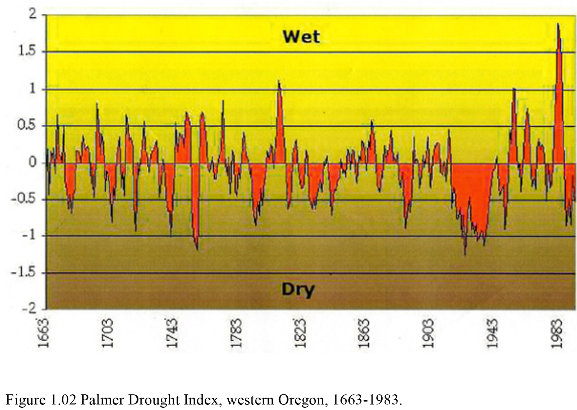
| 1.02 | Palmer Drought Index, western Oregon, 1663-1983. | 21 | FREE_JPG | |
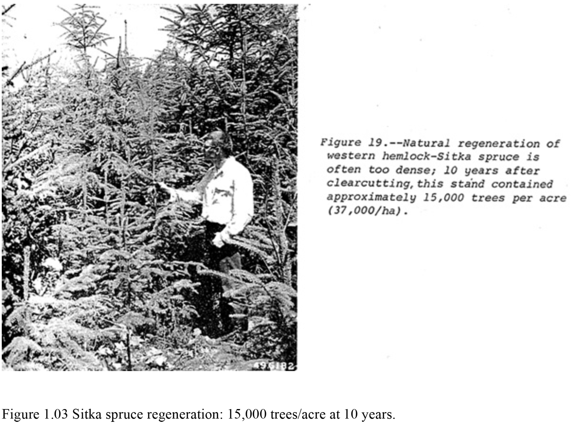
| 1.03 | Sitka spruce regeneration: 15,000 trees/acre at 10 years. | 30 | FREE_JPG | |
| 1.04 | Sitka spruce old-growth, near Waldport, Oregon, 1923. | 31 | $5_PDF | |
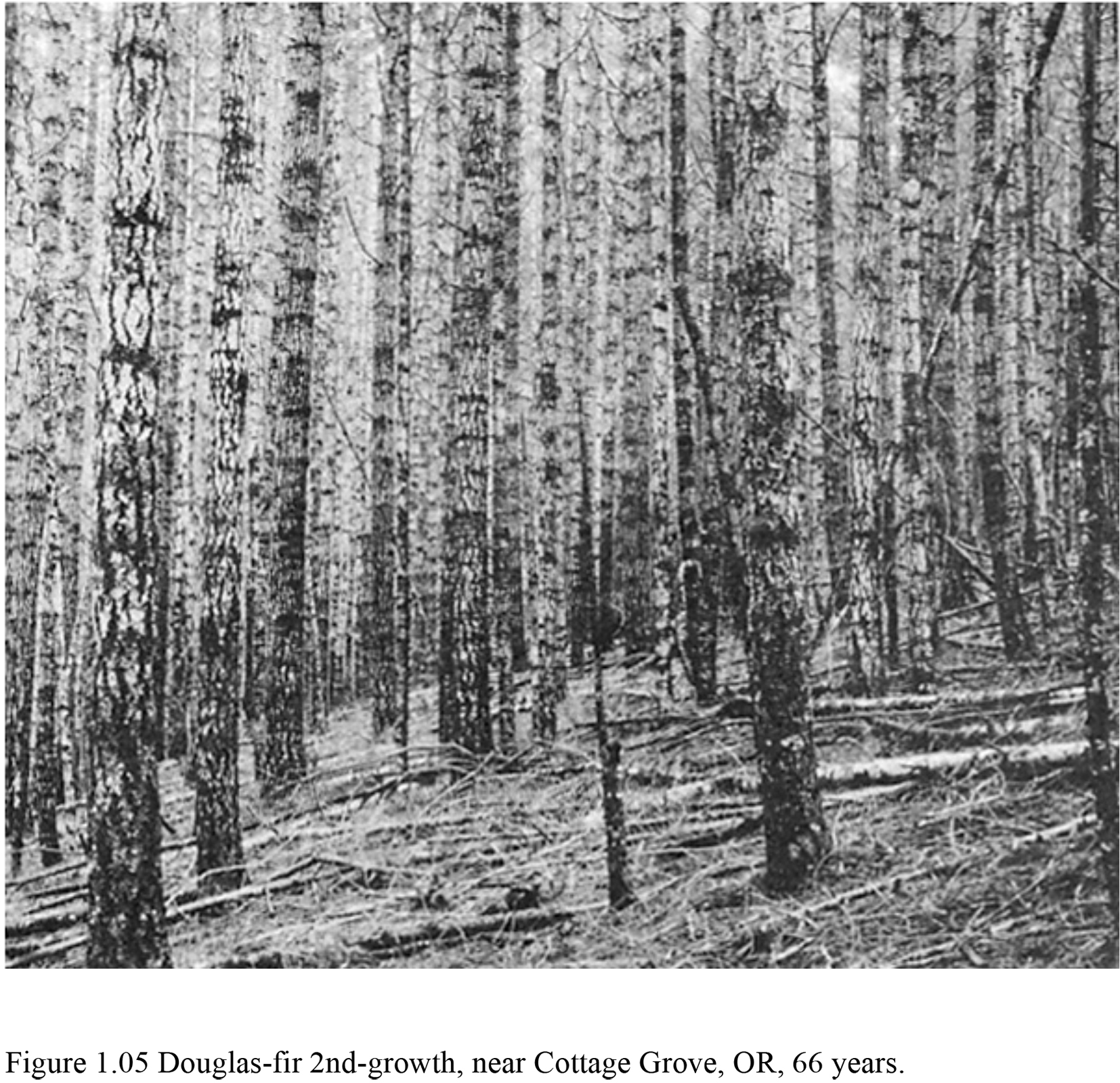
| 1.05 | Douglas-fir 2nd-growth, near Cottage Grove, Oregon, at 66 years. | 32 | FREE_JPG | |
| 2.01 | Grassy bald on Marys Peak, Benton County, Oregon, 1885. | 59 | $3_PDF | |
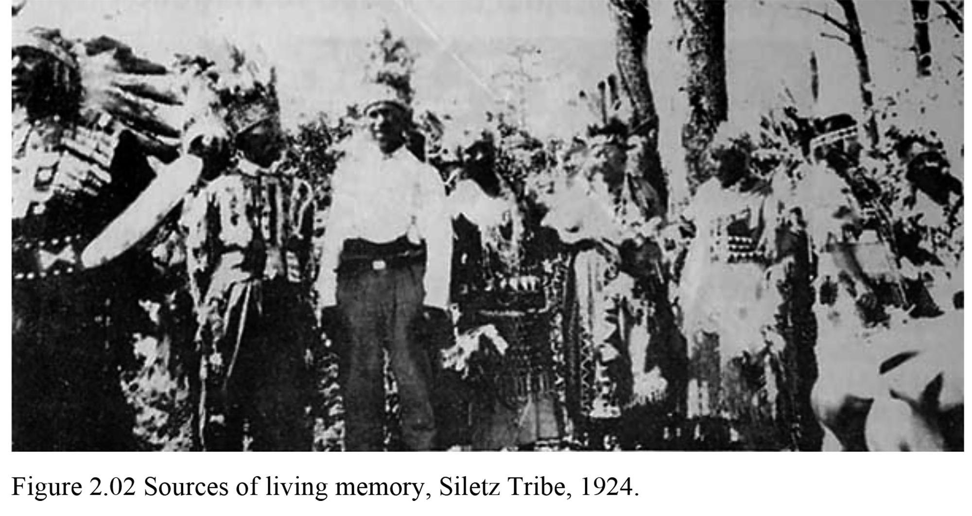
| 2.02 | Sources of living memory, Siletz Tribe, Lincoln County, Oregon, 1924. | 61 | FREE_JPG | |
| 2.03 | Aerial photograph of Alsea town and valley, Benton County, Oregon, June 29, 1948. | 64 | $3_PDF | |
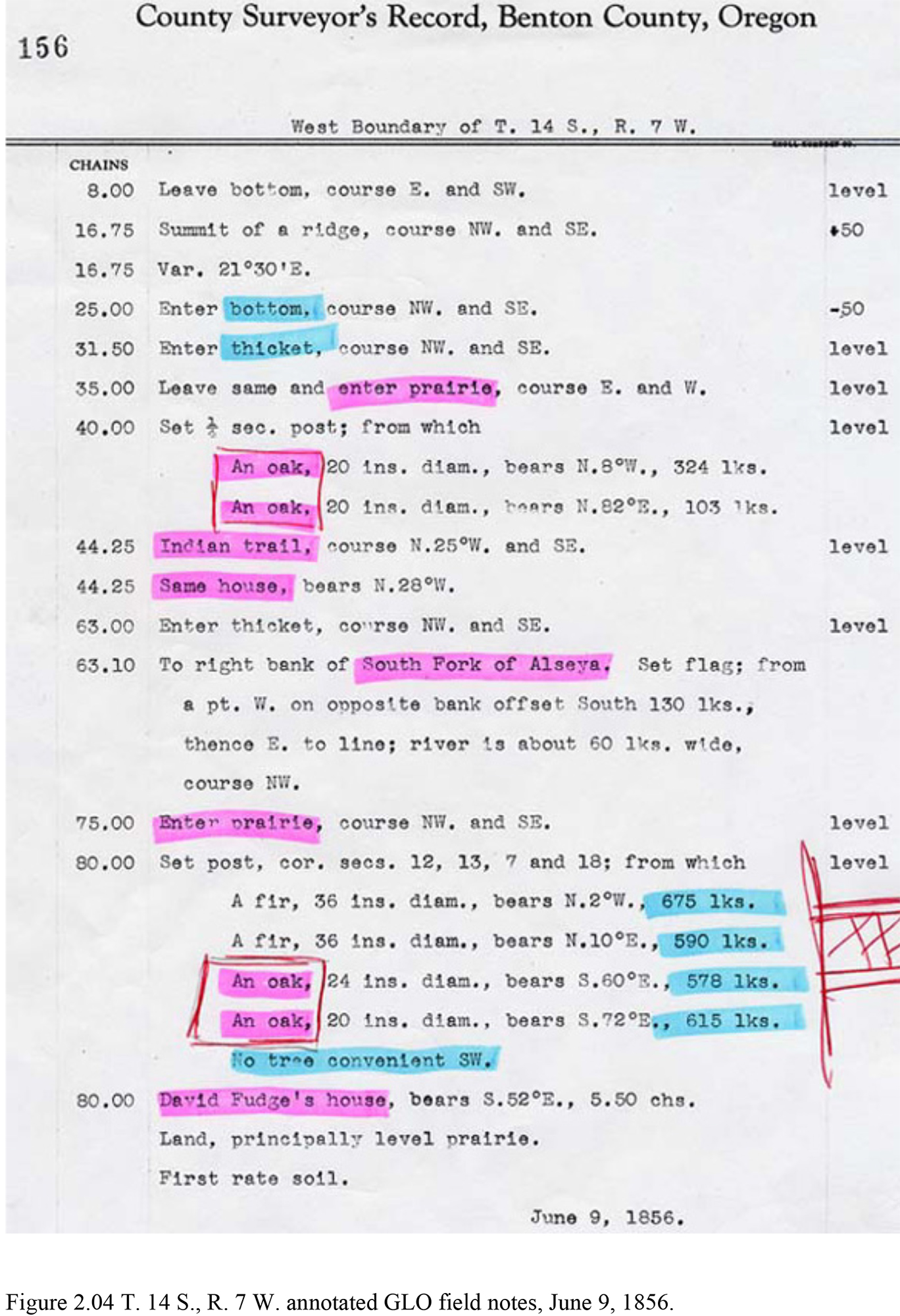
| 2.04 | T. 14 S., R. 7 W. annotated GLO field notes, Alsea Valley, Oregon, June 9, 1856. | 66 | FREE_JPG | |
| 2.05 | Alsea Valley North Fork ridgeline trail network, ca. 1800-2003. | 88 | $3_PDF | |
| 3.01 | Native people of the Oregon Coast Range. | 103 | $5_PDF | |
| 3.02 | Large wood products, Oregon Coast Range, 1788-1860. | 105 | $5_PDF | |
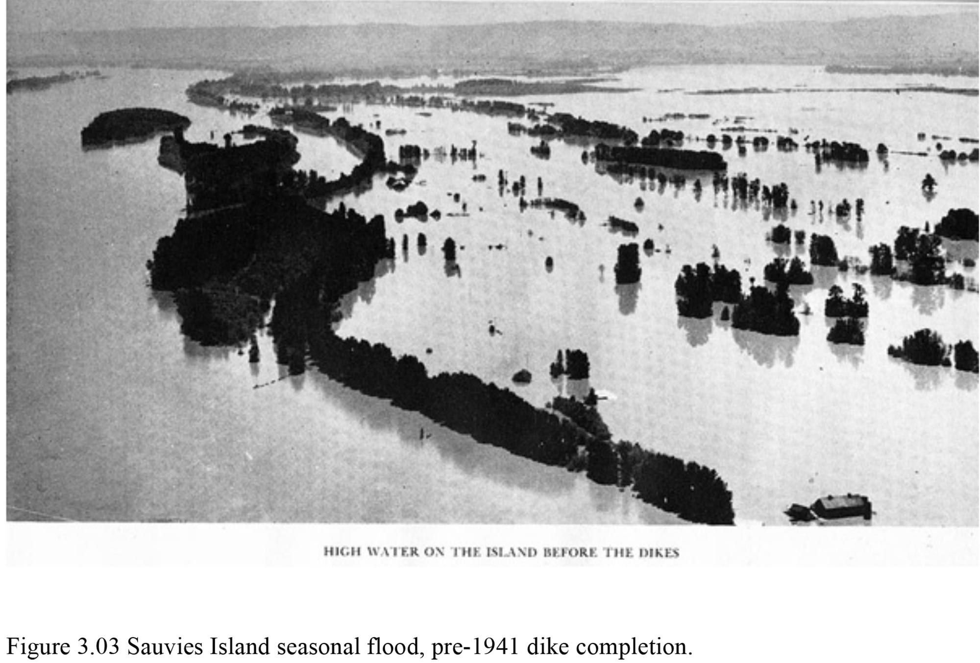
| 3.03 | Sauvies Island seasonal flood, Multnomah County, Oregon, pre-1941 dike completion. | 127 | FREE_JPG | |
| 3.04 | Willamette Valley, Oregon, 1845-1888. | 130 | $5_PDF | |
| 3.05 | Soap Creek Valley, Benton County, Oregon, 1914-1989. | 133 | $3_PDF | |
| 3.06 | Alseya Valley, Oregon prairie relicts, April 14, 2003. | 138 | $3_PDF | |
| 3.07 | Coos Bay (Marshfield), Coos County, Oregon, 1885. | 141 | $3_PDF | |
| 4.01 | Precontact Douglas-fir and white oak old-growth, Oregon Coast Range, 1841-2003. | 151 | $3_PDF | |
| 4.02 | Logging of Clatskanie River basin, Columbia County, Oregon, ca. 1900. | 152 | $3_PDF | |
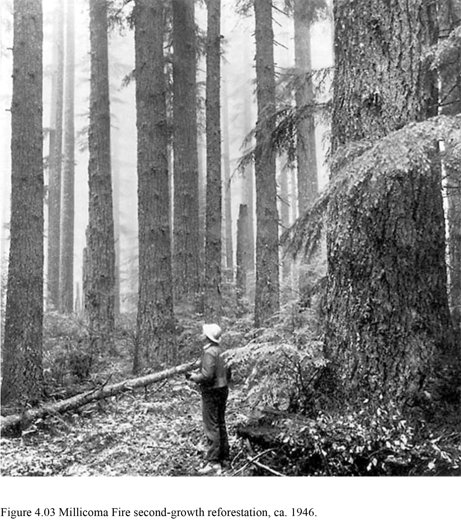
| 4.03 | Millicoma Fire second-growth reforestation, Coos County, Oregon, ca. 1946. | 154 | FREE_JPG | |
| 4.04 | Yaquina Burn, Toledo, Lincoln County, Oregon, 1885. | 158 | $3_PDF | |
| 4.05 | Yaquina and Nestucca burns, Lincoln and Tillamook counties, Oregon, ca. 1902. | 162 | $5_PDF | |
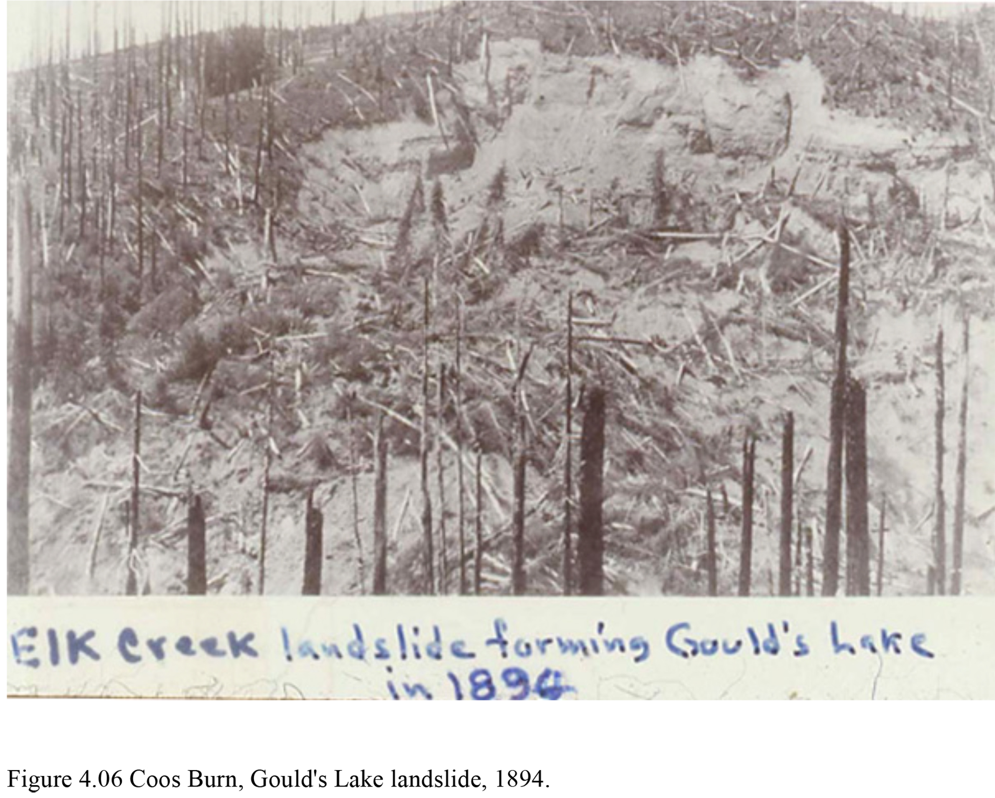
| 4.06 | 1868 Coos Burn, Gould's Lake landslide, Coos County, Oregon, 1894. | 167 | FREE_JPG | |
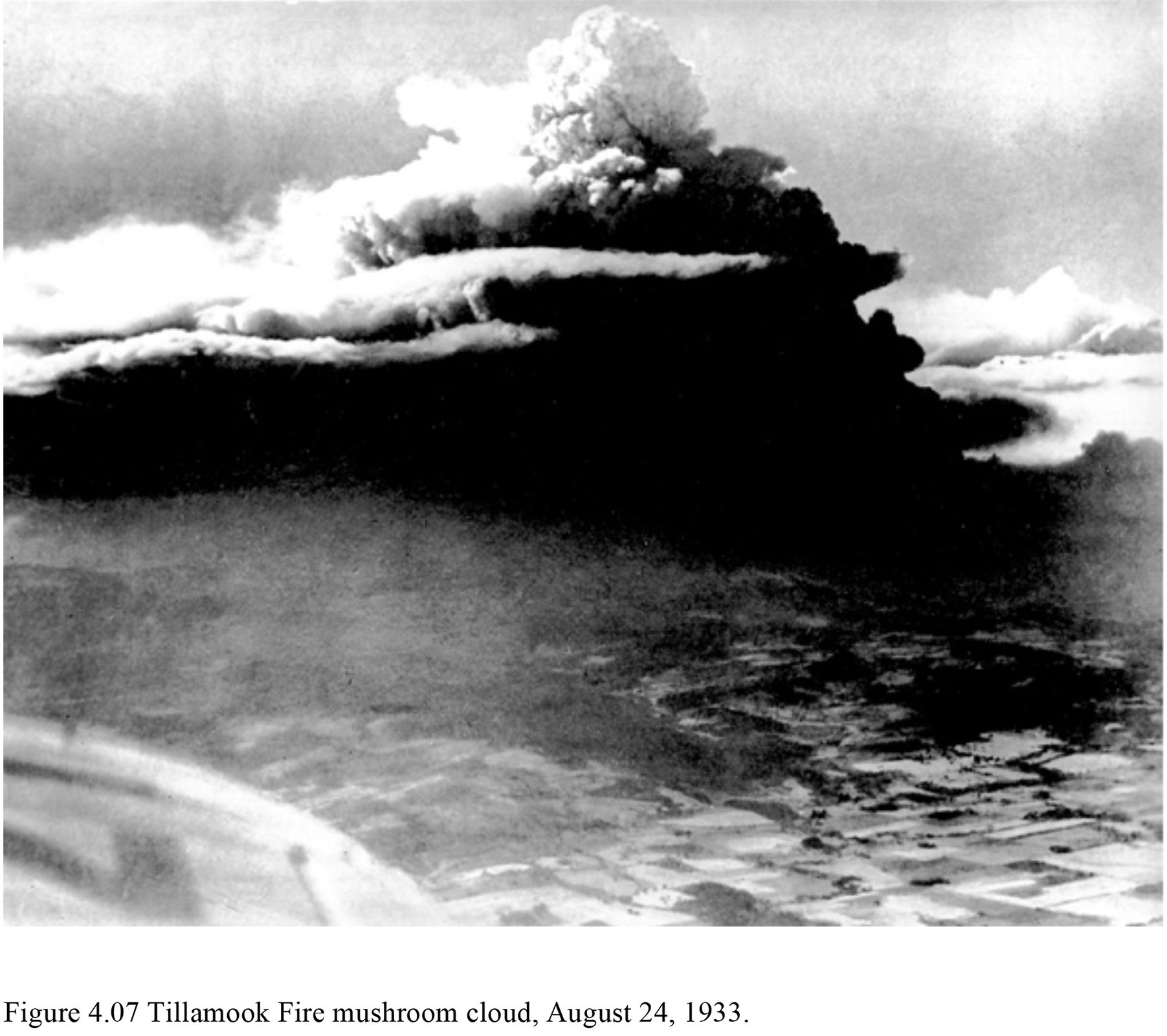
| 4.07 | Tillamook Fire mushroom cloud, Tillamook County, Oregon, August 24, 1933. | 170 | FREE_JPG | |
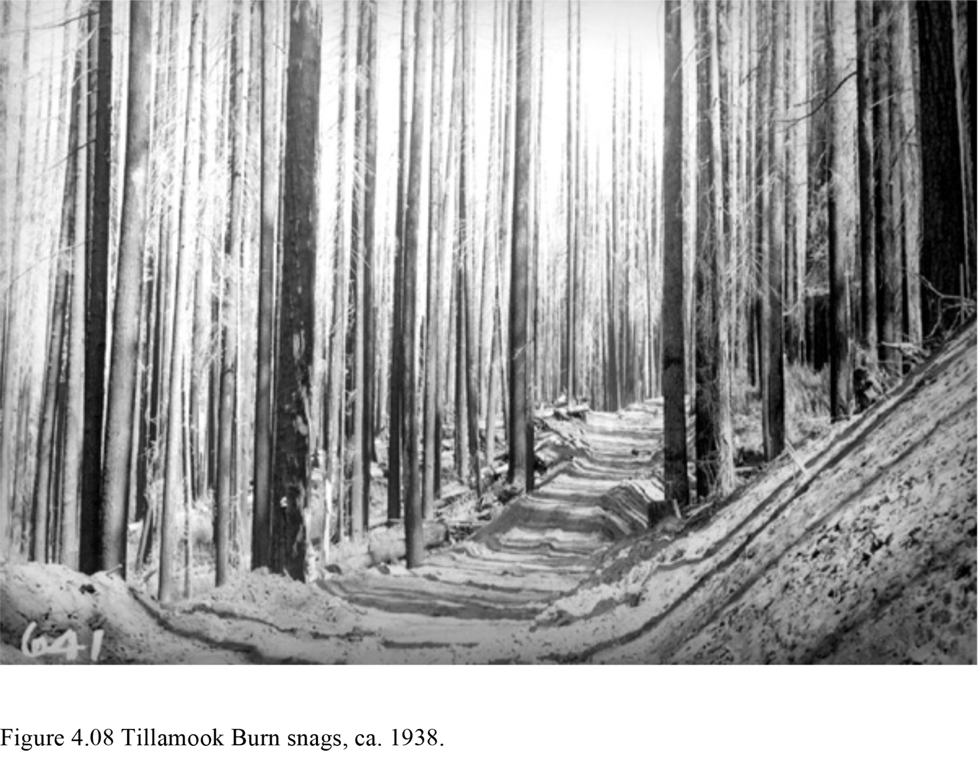
| 4.08 | Tillamook Burn snags, Tillamook County, Oregon, ca. 1938. | 173 | FREE_JPG | |
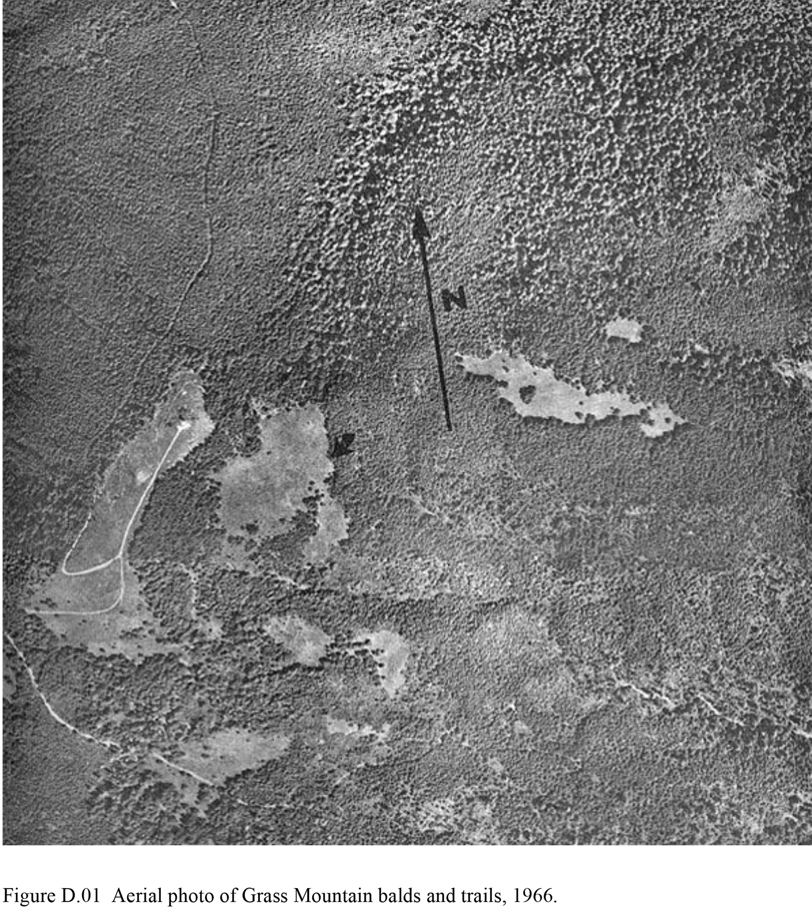
| D.01 | Aerial photo of Grass Mountain balds, Alsea Valley, Oregon, 1966. | 311 | FREE_JPG | |
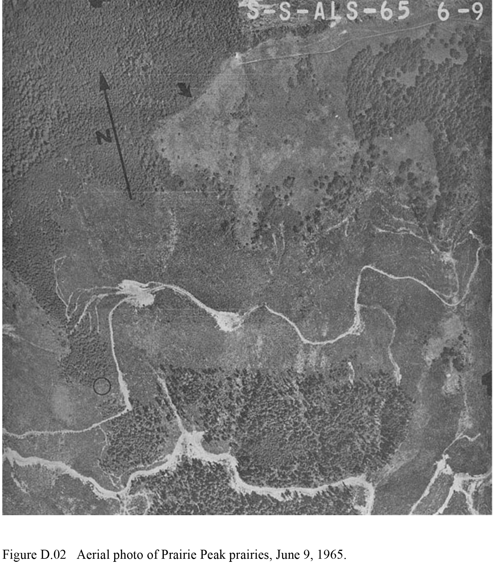
| D.02 | Aerial photo of Prairie Peak prairies, Alsea Valley, Oregon, June 9, 1965. | 321 | FREE_JPG | |
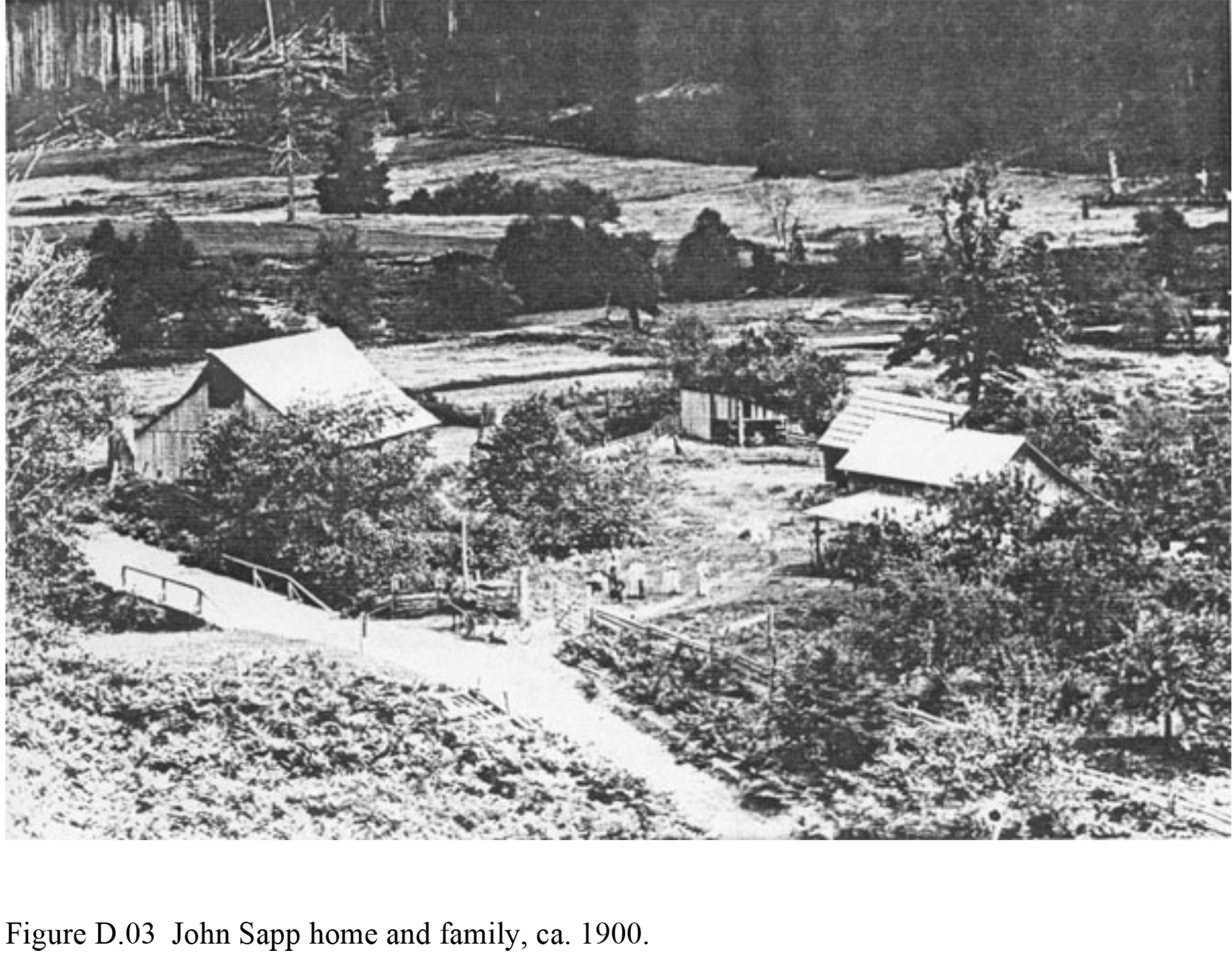
| D.03 | John Sapp home and family, Lobster Valley, Benton County, Oregon, ca. 1900 | 324 | FREE_JPG | |
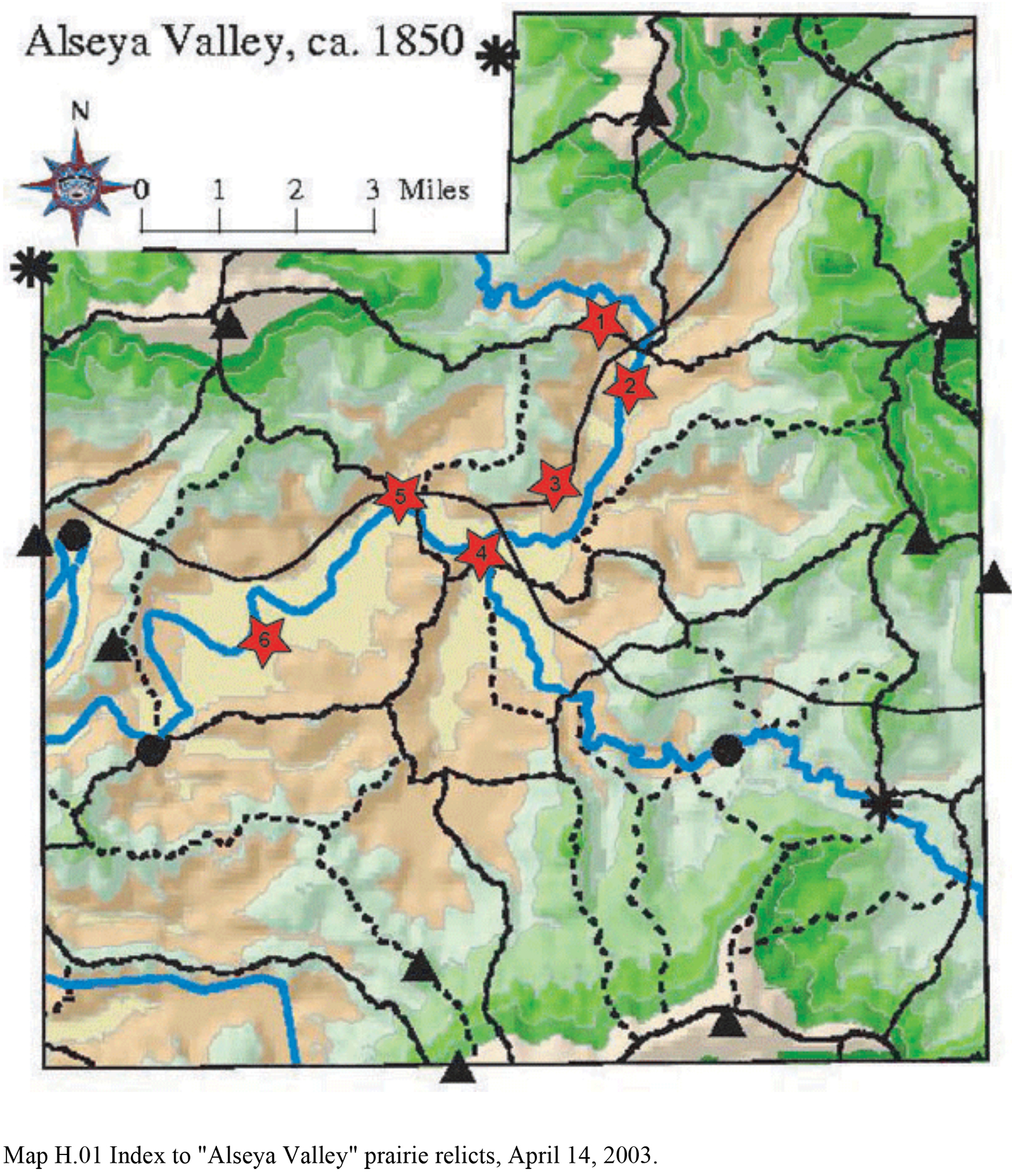
| H.01 | Index to "Alseya Valley," Oregon prairie relicts photographs, April 14, 2003. Note: This map locates photo points for the following Figures in Appendix H. |
337 | JPEG_FREE | |
| H.01. | North Fork Alsea River, Oregon Indian Trail crossing, April 14, 2003. | 339 | $3_PDF | |
| H.02 | North Fork Alsea River, Oregon Indian Trail crossing, early fall, 2003. | 340 | $5_PDF | |
| H.03 | North Fork Indian prairie relict, Alsea Valley, Oregon, April 14, 2003. | 340 | $3_PDF | |
| H.04 | Canoe campsite, North Fork Alsea River, Oregon, April 14, 2003. | 341 | $3_PDF | |
| H.05 | Riparian prairie relict, North Fork Alsea River, Oregon, April 14, 2003. | 342 | $3_PDF | |
| H.06 | Landmark hill and oak savannah relict, Alsea River Forks, Oregon, April 14, 2003. | 343 | $3_PDF | |
| H.07 | Douglas fir stump, Alsea High School, April 14, 2003. | 344 | $3_PDF | |
| H.08 | Mouth of Mill Creek, Alsea Valley, Oregon, April 14, 2003. | 345 | $3_PDF | |
| H.09 | "Old Billy's" homesite, Alsea Valley, Oregon, with rainbow, April 14, 2003. | 346 | $3_PDF | |
| H.10 | Prairie relict near "The Narrows," in Alsea Valley, Oregon, April 14, 2003. | 347 | $3_PDF |
![]()