From 1952 until 1987 -- 35 years -- there was just one wildfire in western Oregon greater than 10,000 acres. The 1966 Oxbow Fire in western Lane County burned 24,000 acres of Bureau Land Management (BLM) Land and 18,000 acres of International Paper ground. At the time it was claimed to be the 5th largest fire in Oregon history since 1910, with only the 1936 Bandon Fire and the four Tillamook "6-Year Jinx" fires from 1933-1951 being larger.
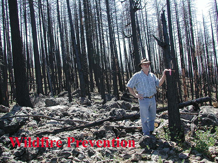
In the past 35 years -- from 1990 to 2025 -- there has been about three dozen such fires with several more than 100,000 acres in size and the 2002 Biscuit Fire at nearly 500,000 acres. Whole towns and communities have been destroyed or heavily damaged, including Blue River, Finn Rick, Nimrod and Vida in east Lane County during the 2020 Holiday Farm Fire.
This increase in catastrophic wildfires was clearly predicted by me and other wildfire and forest management experts in the early 1990s. Our concerns were mostly due to the abrupt change in forest management policies by the US Forest Service that resulted in the Northwest Forest Plan in 1994. The predictions were based almost entirely on inevitable fuel build-ups and normal seasonal weather patterns, including east winds, and had nothing to do with modeled "Global Warming" or "climate change" that was subsequently blamed for these events. The weather has been about the same in western Oregon for hundreds of years, including the most recent 35.
Passive forest management policies, environmental litigation, snag retention strategies, and the decommissioning of access roads were the combination of practices that made these fires so predictable. Rural poverty and business failures, dead old-growth, and major wildlife mortality were also clearly predicted, but no one seemed to realize how many homes would also burn, or how deadly the smoke could be.
According to recent National Library of Medicine research, short-term health effects of “wildland smoke,” such as asthma attacks, are well known and recognized; but a Yale School of Public Health study from 2007 to 2020 also indicated more than 11,000 US deaths per year from long-term effects of wildfire smoke. Lung cancer and cardiopulmonary diseases were identified as major causes.
A University of California study of smoke-related mortality from 2008 to 2018 estimated 52,000 to 56,000 Californians suffered “premature death” due to wildfire smoke inhalation during those years, or about 5,000 deaths per year.
During the 2020 Labor Day Fires, including Holiday Farm, the Oregon Department of Environmental Quality recorded the worst air quality in the world, including record-setting “Air Quality Index” (AQI) numbers for the Portland, Eugene, Bend, Medford and Klamath Falls communities.
AQI numbers for these towns varied from 332 to more than 500. A “Good” AQI number is from 0 to 50; “Unhealthy” numbers are 101 to 200; 200-300 is considered “Very Unhealthy,” and anything 300 and above is considered “Hazardous” — 500 is the highest number that can be measured, and Bend even exceeded that rating.
The 2022 Cedar Creek Fire blanketed the towns of Oakridge and Westfir with smoke for nearly two months, including a forced four-day evacuation. During that time AQI numbers were from 100 to 199 for 19 days; from 200 to 299 for 11 days; and from 300 to 399 for seven days -- 51 calendar days, of which 37 varied from "unhealthy" to "hazardous."
Smoke from the fire moved into southwest Washington on September 10, and Seattle recorded the worst air quality of any major city in the world, with Portland coming in third out of the top 90, and Lahore, Pakistan sandwiched between the two. Seattle's AQI was 170 and Portland's was 152.
This didn't need to happen. The wildfire was said to have been poorly managed by the Forest Service for an entire month before predictably exploding on an east wind in early September. By the time it was fully extinguished on November 22, taxpayers had spent more than 132 million dollars to employ more than 2500 firefighters that had operated dozens of helicopters and heavy equipment for the previous three months. Very little of the $132 million stayed in Lane County, and almost all cost was borne by US taxpayers.
Our ancestors on the land showed us how to fix this problem. Stopping costly lawsuits, onerous planning processes, and passive management policies are key. Restoring active management of our public roads, trails, and forests will mostly end these deadly events, and also provide jobs and income needed to restore our rural schools, industries, communities, and clean, healthy air.
The effective 1935 "10 A.M. Policy" in which firefighters worked through the night in order to have fires completely out by the following morning could be reinstated. Local firefighting teams, smokejumpers, and other first responders could be paid higher wages and bonuses for risky assignments and better results.
We didn't have these events for nearly two generations that followed WW II -- in large part because we had thousands of workers, recreationists, and visitors traveling well maintained roads and trails throughout our forests. Many of these folks likely started thousands of unintentional fires, and many more were readily available with 4WD pickups, shovels, chainsaws, water pumps, and fire extinguishers to put them out.
On June 12, 2025 President Trump issued Executive Order (EO) 14308, titled "Empowering Commonsense Wildfire Prevention and Response." The order directs federal agencies, particularly the Departments of Agriculture (USDA) and the Interior (USDI), to "consolidate and streamline their wildland fire programs to improve efficiency." It also focuses on encouraging local preparedness and response, strengthening wildfire mitigation by examining regulations that may hinder prescribed burns and fire retardants, and by modernizing prevention and response efforts through technology.
Campaign Website: https://www.zybachforlane.com/wildfire-prevention
Platform Menu: http://www.nwmapsco.com/ZybachforLane/Platform/
Books by Dr. Zybach
Zybach, Bob 2018. The Great Fires: Indian Burning and Catastrophic Forest Fire Patterns of the Oregon Coast Range, 1491-1951. 2nd Edition, NW Maps Co., Cottage Grove, Oregon USA: 347 pp.
Zybach, Bob 2024. Western Oregon Wildfires: An Anthology. NW Maps Co. Cottage Grove, Oregon USA: 132 pp.
Videos of 2020 Holiday Farm Fire Aftermath (Zybach and Peters 2020)
#1 Deerhorn to Vida (23:17)
#2 Vida to Finn Rock (38:59)
#3 Finn Rock to Blue River (23:21)
#4 Blue River to Rainbow (29:31)