Chetco River Basin
Osborne Panoramic Photographs, 1934 - 1937
Kalmiopsis Wilderness QTVR Grid, 2006
![]()
View of Red Mountain and Chetco Peak to the SE, from Vulcan Peak USFS Fire Lookout, June 26, 1937. Nearly all the visible landscape, for a distance of 8 to 10 miles, is now part of the Kalmiopsis Wilderness and is mostly composed of Jurassic volcanic rocks, among the very oldest in Oregon. This area burned during both the 1987 Silver Complex and 2002 Biscuit Fires. Click on the image with your Mouse to add QTVR navigation and zoom capabilities to this photograph.
This web report is intended as a model for characterizing early historical information (Osborne photographs) into modern digital formats (JPG and QTVR). This process creates new products that can be used for additional purposes and can be duplicated, transmitted, or transformed into an unlimited variety of formats quickly and cheaply.
This project is a direct result of the B&B Complex Repeat Photography Grid Project and is intended to serve similar purposes for other areas affected by catastrophic loss of forest lands; including the Silver-Biscuit Complex Fires of 1987 and 2002. These maps, historical photograph duplications, and QTVR files are made available by NW Maps Co. at no charge for their use or reasonable reproduction.
Area Maps and Photo Point Indexes
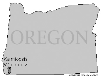 |
Location of Kalmiopsis Wilderness in Oregon, USA. |
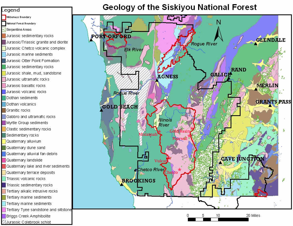 |
Geology of Chetco River Basin and Kalmiopsis Wilderness, Oregon. Big Craggies volcanics complex and other Jurassic rocks characterise headwaters; Dothan sediments throughout lower elevations to the west. |
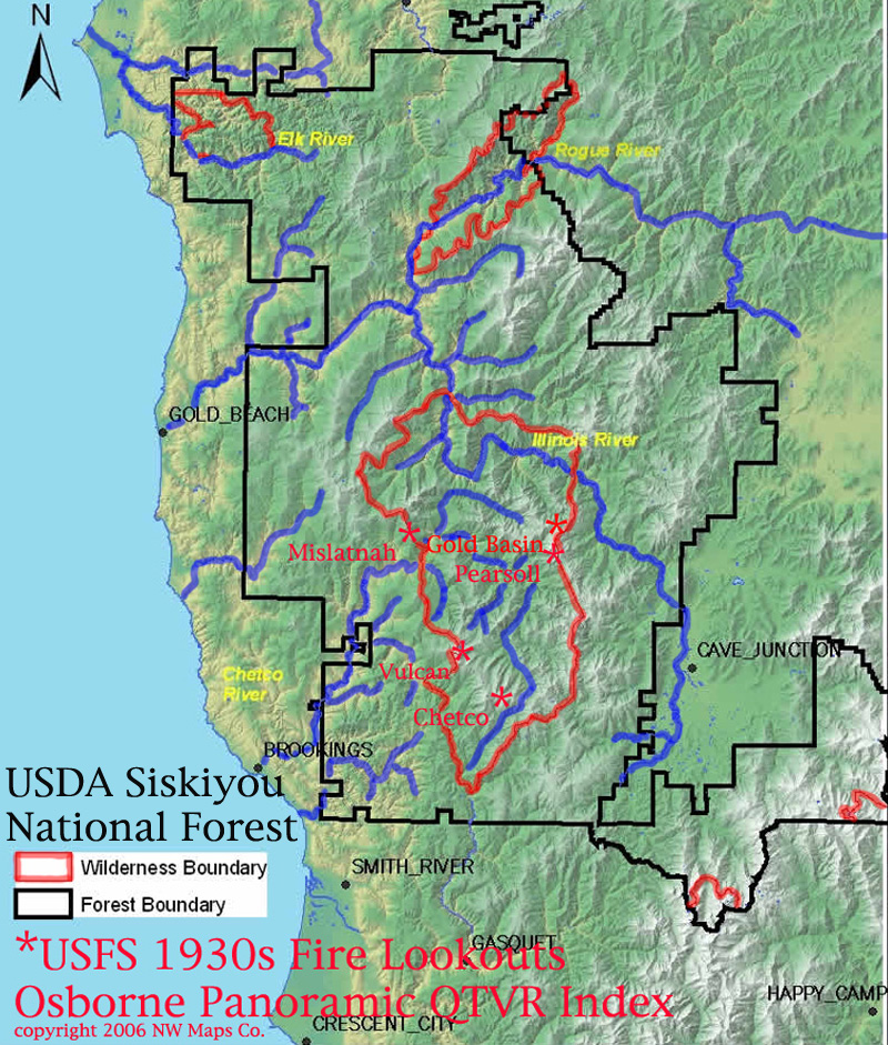 |
Index to 1934-1937 Osborne Photo Points in Relation to Kalmiopsis Wilderness, Oregon. The photographs were taken from US Forest Service fire towers during the 1930s, more than 40 years before the Kalmiopsis was created in 1978. |
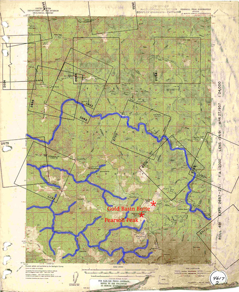 |
1957 USGS Pearsoll Peak Quadrangle Map with Osborne Photo Points, Chetco River, Oregon. Trails, springs, grasslands, shrublands, and nut orchard patterns remaining from 1840s and earlier. Roads and cabins from miners and ranchers, 1850s to WW II. |
Osborne Landscape Photographs (JPG) and QTVR Panoramas
Chetco Peak (June 25, 1937). 360-degree view of headwaters of Chetco River, currently within Kalmiopsis Wilderness boundaries. This must have been an important place to Chetco Nation during precontact time (1760s and earlier). See Index Map. See Geology Map. |
||
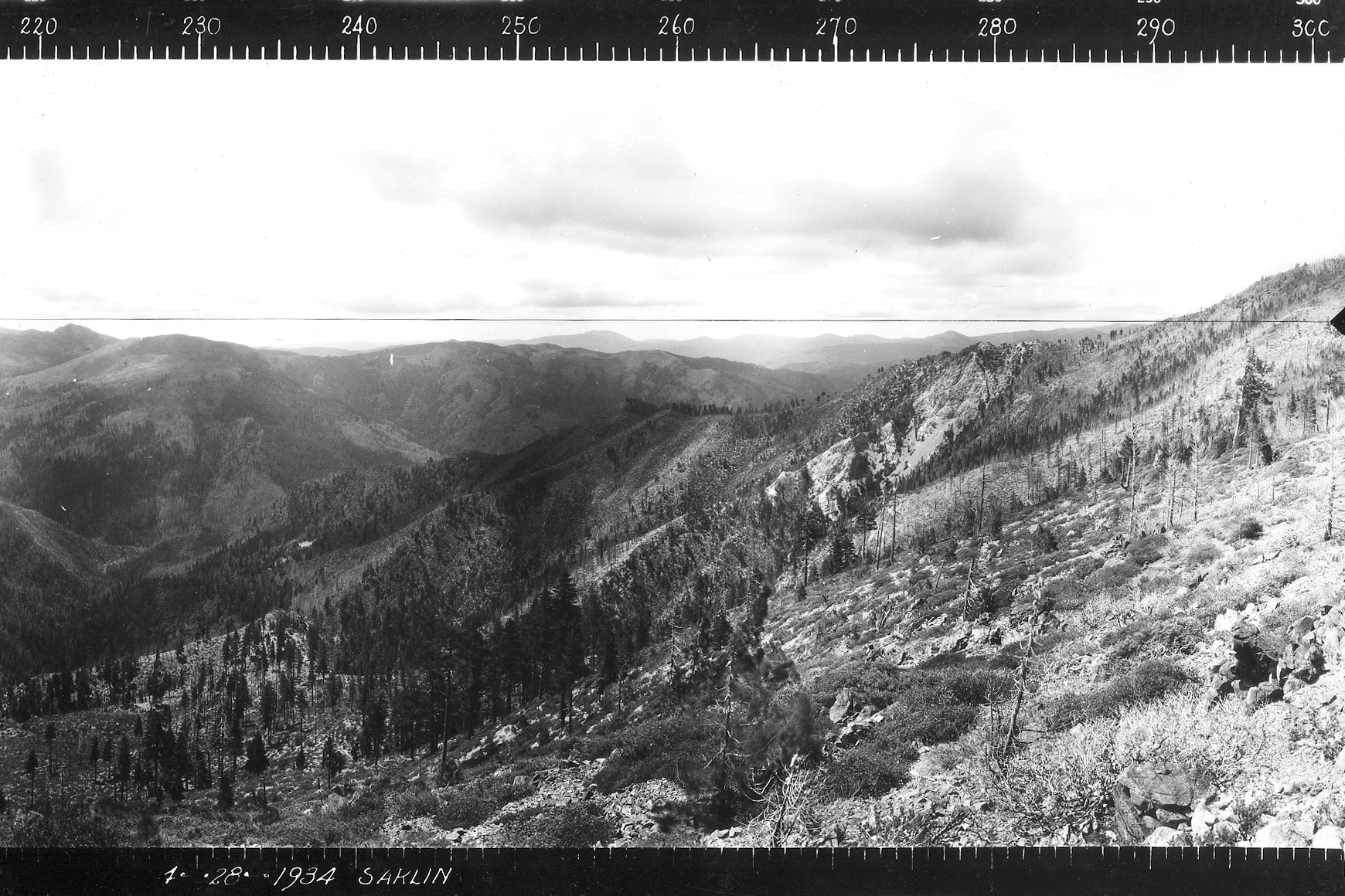 |
Gold Basin Butte (July 28, 1934). View of Kalmiopsis Wilderness from due south, then east to Mislatnah, and north, and then 50-degrees NE. Spectacular view of Chetco River Valley. Nice hat. See Index Map. See 1957 Quad Map. |
|
Mislatnah Peak (April 6, 1934). View of Kalmiopsis Wilderness Jurassic volcanics, from Green Craggies and Big Craggies to the NW; Gold Basin and Pearsoll Peak due east; and Chetco and Vulcan Peaks to the SE. See Index Map. See Geology Map. |
||
Pearsoll Peak (April 21, 1934). Located about one-mile SW of Gold Basin Butte, NE of Chetco and Vulcan Peaks, and due east of Mislatnah. See Index Map. See 1957 Quad Map. |
||
 |
Vulcan Peak (June 26, 1937). A single Osborne frame (1 of 3), from 60-degrees NE to 180-degrees due south. See description at top of page. See Index Map. See Geology Map. |
This website created by Bob Zybach, with technical help by Josh Meredith, Oregon Websites and Watersheds Project, Inc., February 21, 2006, and updated through March 3, 2006.
![]()
© 2006 NW Maps Co.